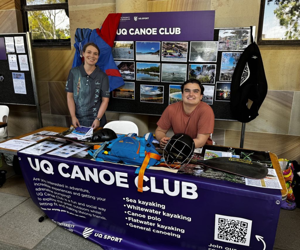

<$MTInclude module="Navkey seakayak"$>
|
A Lovely paddle through Nundah creek and the Boondall wetlands. There is lots of birdlife and very interesting paddling. This trip will be a full Day. There are limited numbers on this trip (limited by transport for people and kayaks).
We will depart from Shorncliffe on Cabbage Tree Creek beach. Drive along Allpass Pde to a good spot.
Morning circuit (9am to 11am):- We will proceed up Cabbage Tree Creek and back for a two hour leisurely paddle with frequent rests, aiming to be back at the beach by 11 am.
Stroke and rescue practice (11 am to 12 pm) This will be an opportunity for everyone to practice stroke and rescue techniques with more experienced kayakers providing assistance.
Lunch (12 to 1pm): We will kayak back to the Fish Cooperate for a fish lunch.
Anyone who has had enough can return to the beach and enjoy the pleasures of Shorncliffe during the afternoon (bring a book!)
Afternoon Circuit (1pm to 4pm): A final decision about the afternoon circuit will depend on the weather and the skills of the participants as assessed by the leader. It will also depend on having sufficient kayakers with experience to help and teach beginners. We will not go on to Moreton Bay unless conditions are favorable and the group has the required basic skills both to kayak and to rescue.
- Option A
Weather and skills permitting we will exit Cabbage Tree Creek before the tide turns (high tide 1.33pm) then proceed across the sand banks (shallow water) south along the coast between Mangrove trees towards the Brisbane river. We will return to Cabbage Tree Creek via Nudgee Creek and Nundah Creek with a short portage between them. - Option B;br>
If there are concerns about the weather or other matters then we will explore the Nundah Creek returning to Cabbage Tree Creek with the outgoing tide
Safety:- Sea kayaking on Moreton Bay can be hazardous, particularly in river mouths with an outgoing tide. Because this is an introduction for sea kayak beginners we will exit the creek before the tide goes out and will paddle across shallow water over the sand banks along the edge of the bay
Grade: 1
Time: Sun 11 March 2007
Duration: All Day. We will plan to be off the water by 4pm and back at the shed by 5pm. Up to 4 hours kayaking and up to 1 hour practicing.
Distance: 15km. We will be looking at a total distance of around 15 km or more if everyone is coping well. This is a pleasure outing.
Paddle type: Sea kayaking
Requirements:
- Basic fitness – although this trip will cater for beginners, some basic skills and some fitness by kayaking on the river are required. If you can kayak comfortably up river from the club to the green boy on the rocks and back then you should manage the morning circuit. You can then decide on the afternoon circuit.
- Basic skills training session. You must have already attended a Nasic skills training session at the St Lucia Shed. It is UQ club sea kayaking policy that only those able to demonstrate that they can use a skirt, do a wet exit and an assisted rescue will be taken onto Morton Bay. The practice session will enable you to learn and demonstrate these skills.
- Prior bookings are essential
Required equipment: Sea kayaks, skirts, paddle leashes, bailers and PFDs are required. Bring snacks, at least 2L WATER, sunscreen, hat, sunglasses, insect repellant, money, hat, towel, swimming gear and change of kayak clothing as you will get wet.
Basic Costs: Money for Lunch (or bring your own) about $10. Money to put toward petrol of your driver (about $5-10). Money to donate for kayak upkeep (about $5)
Meet: 7:15AM at the UQ Canoe Club to load kayaks. Depart 8am and drive to Shorncliffe (near Jetty at junction Allpass Pde and Sunday Rd – Brisbane UBD Map page 9)). Aim to be on the water by 9am or soon after.
Tides: High tide is at 1.30 pm so we will be kayaking both with and against the tide.
Registration: Please register your interest with the leader by email (first come first served). Please indicate whether you have transport and if you have roof bars for kayaks. If you have not kayaked with the leader before please give some indication of your skills level to assist planning. We do not intend to turn people away because they are beginners.
Organiser: Michael Wynne
Leader: Dave Loveridge
Contact: Michael or Dave Loveridge (sea kayaking rep)
Report
This was the first trip of the year, and had a roughly equal mix of older club members and new members on their first sea kayak trip. We arrived at the Shorncliffe boat ramp, where the Sandgate canoe club has its kayak washing station, and departed on schedule. We set off up Cabbage tree creek for a couple of hours exploring the Mangroves. All the club’s sea kayaks were in use, and the double kayaks forged ahead with the new one (on its maiden trip) leading the way. It was also the first trip for Marj’s flash new fibreglass sea kayak – very nice. Despite the progress of the doubles, it was a leisurely meander upstream in ever increasing heat. Luckily a decent onshore breeze saved us from too much discomfort in what was otherwise a very hot day. We returned on schedule, but postponed the training sessions because the water was uninviting, particularly with respect to the number of jellyfish. We settled down to a lazy lunch instead.
After losing a couple of paddlers to the lures of an afternoon kip, we headed off along the shore and into the bay. On our way out of the creek we hit a patch of very high density jellyfish, with probably around 20-30 per square metre. In the bay the breeze was driving some onshore waves which provided a useful first experience for the new paddlers. However, the waves were just too small to demonstrate the utility of spray decks, or to provide a decent taste of surfing fun. We played in the bay waves for over half and hour before coming through the mouth of Nudgee creek at high tide.
After a short trip up the creek, and a demonstration of some novel paddling techniques, we ported the kayaks across to Nundah creek. The opportunity was taken for more stroke and paddle training before heading back to Shorncliffe and the trip home.
– M.W.
We will start from Golden Beach Caloundra and kayak 16 km to a campsite half way up Coochin Creek where we will spend the night. We will make an early start on Sunday to kayak about 26 km from the Coochin Creek camp site to the Bribie island bridge.
Details
Tides in the Bribie passage can be very strong at both ends so it is important that we use this to our advantage fully. The time we take and opportunities for exploration will depend on how well we do this.
On the way up to Caloundra we will leave cars at the Bribie bridge and at the Coochin camp site (with heavy camping gear, food etc.).
We will try to get on the water before 10 AM. This should give us an hour or more to kayak across to a narrow area of Bribie Island where we can swim or walk across to the sea and beach while we wait for the tide to slow. It is possible to carry a kayak or two across and play in the surf. We will start up the passage and leave Golden Beach at 11 AM, This is one hour before low tide. It should take 3-4 hours of kayaking to reach the camp site in the late afternoon, depending on the wind.
On Sunday morning we will pack up early, and be on the water by 7 AM. An early start means we can explore Tripcony Bight and other areas, and still reach Bribie bridge soon after the tide changes at 2.15 PM. This last part could be hard work against a strong tide at the end of a long trip, so we will try to avoid this by starting early. This is a long trip, and is a good 5 hours of actual paddling, not including stops to rest. It may be against the wind.
The Bribie passage is scenic, and is lined along much of its length with mangrove and mud bank with the glasshouse mountains in the distance. There are exit points, but they are infrequent in some areas. In the centre is the fish breeding reserve called Tripcony Bight. It is only navigable at high tide which is when we will explore it. Bird life is abundant as are insects, so bring repellent.
Safety note
The prevailing wind is usually from the south east, so we will probably be paddling against the wind. Although these are sheltered waters, parts of the passage are up to 3 km wide and can be rough, so skirts are required. Some central parts are only a few metres wide.
Contingency plans
There are access points at the towns of Donnybrook and Toorbul on the Sunday so we can drop off anyone finding it too difficult on day 2, and retrieve them at the end of the day. If strong or gale force SE winds are predicted (as they were last time) then a last minute change to plans may be made – leaving much earlier on Saturday, starting at the Bribie bridge, and ending at Caloundra on Sunday.
Time: Sat-Sun 14-15 April
Duration: 2 Day / overnight
Paddle type: Sea kayaking
Distance: Approximately 16 km (day 1) and 26 km (day 2)
Tides: Low tide (Caloundra) at midday on Saturday, and at 2.15 pm at Bribie bridge on Sunday. High tide in the centre of the passage will be approximately 8-9 PM on Saturday and at 9-10 AM on Sunday. This is 2-3 hours later than the time at Bribie and Caloundra.
Requirements:
- Basic fitness – You must be able to paddle for 2 hours at steady 5km per hour, and a total distance of 26 km
- You must have already attended a training session at the St Lucia Shed and learned basic paddling and rescue skills.
- Prior bookings are essential
Accommodation: Camping. The club has basic camping gear (tents, sleeping bags, sleeping mats, cooking stoves) – if necessary check and book it well beforehand. Please let us know what you need.
Gear: Kayak gear (the club has this) including skirts, pdf’s, dry bags, paddle leashes. Personal gear – sunscreen, insect repellent, hat, sunglasses, warm clothes, food, snacks and over 6 litres of water. It is not known if there is fresh water at the camp site.
Basic Costs: Camping fee (to be determined), a contribution to petrol to be determined afterwards, and a voluntary boat/gear donation to the club (towards up-keep) for those who can afford it.
Meet: Canoe club shed at 7 AM on Saturday 14 April 2007. Load boats and depart before 8 AM
Destination: Pumicestone Passage – Caloundra, Coochin Creek, Bribie Island
Return: Sunday 15th April late afternoon. Or early evening.
Coordinator: Please register interest with Michael Wynne before 7th April. Please supply email and phone (mobile) contact numbers if I donít have them.
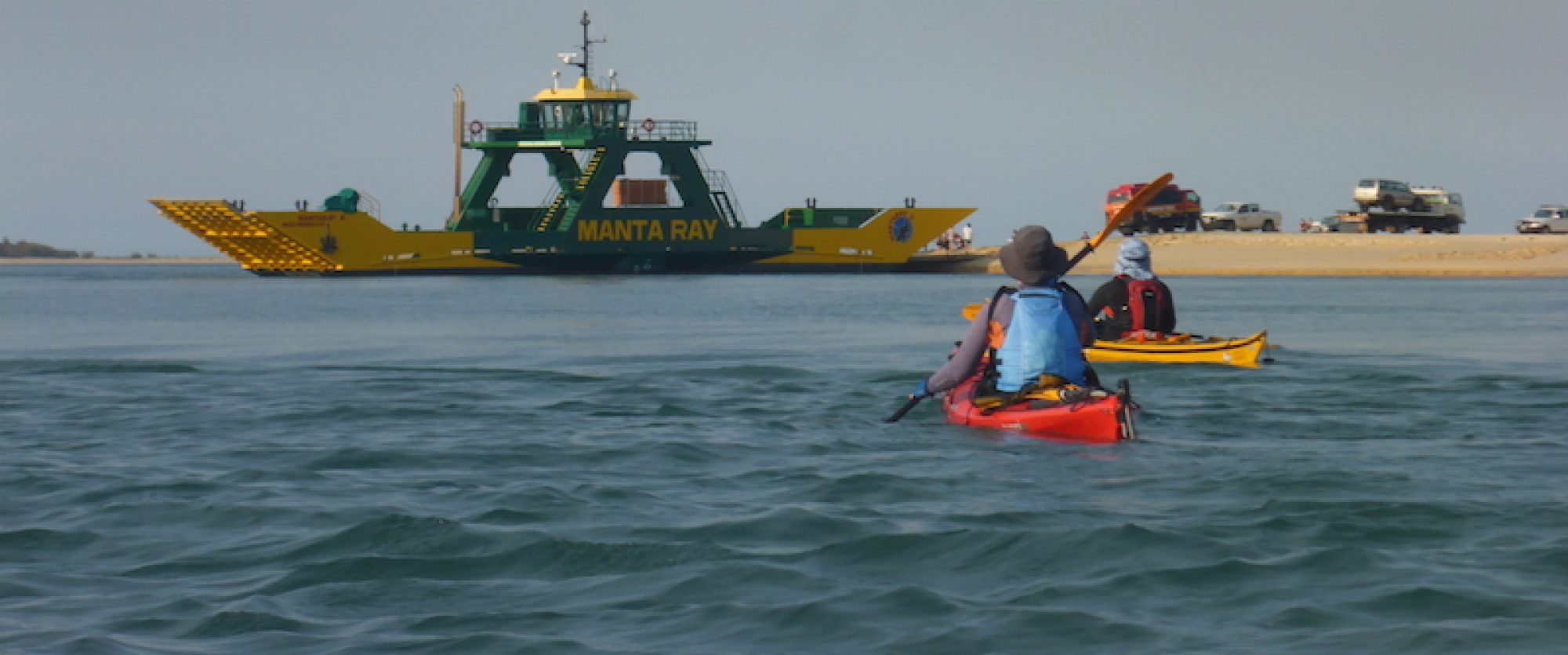
We will be catching the Barge from Lytton to Tangalooma and camp somewhere around Tangalooma. We shall paddle along the island during the day, following the tides. On the Sunday we will paddle to the sand hills or snorkel around the wrecks at Tangalooma. Monday we will return to Bulwer for the Barge back to
Lytton. There are additional costs such as the barge and camping
fees.
Time: Sat 5th May – Monday 7th May (Labour day long weekend)
Duration: 3 days / 2 nights
Paddle type: Sea kayaking
Requirements:
- Basic fitness
- Skills training session. You must have already attended a training session at the St Lucia Shed
- Prior bookings are essential
Accommodation: Camping. The club has basic gear – if necessary check and book it well beforehand.
Gear: sunscreen, hat, warm clothes, organise transport and food
Basic Costs: $80 – these include the barge and camping
fees
Meet: Fri 4th May 6:30 PM (packing), and Sat 5th May 3:15 AM (leaving) at the club shed
Destination: Moreton Island
Contact: Dave Loveridge (sea kayaking rep)
Report: After a very early departure, we made good time to the barge. The organisation and planning paid off, and we loaded our things quickly and easily. The sunrise while we were on the ferry in the middle of Moreton bay made the early start worth it. The trip time was used to repack the kayaks so we were ready to immediately set off for a very early paddle through the Tangalooma wrecks when we landed – again well worth it. We paddled over to Tangalooma point where we set up camp (we had first choice of sites on a very busy weekend!), and had something to eat. Afterwards, we paddled south past shark point for a quick swim, and then back back to Tangalooma where we met Marj and Paul. They had kayaked across from Bribie island, and joined us for the weekend. We had some lunch, a swim amongst the wrecks, and an afternoon snooze to fix the early start. The water was pleasant, and there were many fish and corals growing on the wrecks. When the tide was right, we returned to our campsite for the evening.
The next day we took a trip further south, spotting rays, turtles, and even a small shovel-nosed shark along the way. We stopped at the Big Sandhills for lunch. The sandhills were impressive, as was the view from the top. We weren’t far from the southern end of the island. After lunch and a swim we paddled back to the campsite. The water was so beautiful and blue-green on the way back that we couldn’t resist a jumping overboard for a swim. After same afternoon nibbles, we walked down to the resort for a beer, and did the tourist thing – watching the dolphin feeding just after it got dark.
We had an early start the next morning, especially those who got up with Marj and Paul who’d decided to leave us early and paddle back to Lytton (via Mud island). We packed up the camp and had an easier than expected paddle against the current over to Tangalooma to meet the ferry. Consequently we took a small detour via the point at Cowan Cowan, and a last swim to the wrecks. We were lucky to catch the early ferry back because the winds picked up, and it wasn’t as nice a day as the previous two. Despite the conditions, Marj and Paul beat us back to Lytton. – M.W.
Trip completed
[Original trip plan (Peel island) – Cleveland to Peel Island for lunch, a play and a swim and then back. It would be approx 20 km of paddling in the day, including a 5-6 km crossing from the mainland. If this sounds like something your interested in let me know. It will depend a bit on the weather.]Poor weather conditions: The trip will instead go to Victoria Point where it is more sheltered, and kayak around the islands there (Coochimudlo and Macleay islands) subject to weather conditions
Time: Sat 26 May
Duration: 1 Day
Paddle type: Sea kayaking
Requirements:
- Basic fitness
- Skills training session. You must have already attended a training session at the St Lucia Shed
- Prior bookings are essential
Gear: sunscreen, hat, warm clothes, organise transport and food
Basic Costs: donation to the club for equipment use & petrol money
Destination: Coochiemudlo and Macleay islands, Moreton Bay
Contact: Dave Loveridge (sea kayaking rep)
The trip was completed. We traveled from Victoria point, along Coochiemudlo island, and then headed across to Macleay. After navigating the low tide sand banks between the two islands, we followed the north end of macleay island to and rounded the eastern end. We then surfed the small swell back to Coochiemuldo for lunch. Afterwards we continued around Coochie, noting the corals in the water, and arrived back at Victoria point in good time.
Get into the semester with paddle from Tumbulgum (on the Tweed River), travelling up the Rous River (pronounced “Russ”) with the tide to the limit of the tidal range (just past the boat harbour bridge (~20 km). There are exit points after 10 km and 15 km if needed. We will be taking sea kayaks, and slower paddlers will use Rosco kayaks.
Distance: 19.5 km (exits at 10km and 13 km if needed)
Date: Sat 21 July – the weekend between O-week and the start of semester
Duration: 1 Day
Grade: 1 – note 19.5 km is 5 km longer than a normal grade 1 trip. However, it is with the tide.
Paddle type: Sea kayaking / Flatwater
Requirements:
- Basic fitness
- Skills training session. You must have already attended a training session at the St Lucia Shed
- Prior bookings are essential
Gear: sunscreen, hat, warm clothes, organise transport and food
Basic Costs: Kayak usage donation / petrol money
Meet: Club shed – 6:30 AM
Return to shed ~5 PM
Destination: Rous River, NSW
Contact: Michael Wynne
Trip completed.
Circumnavigation of Coomera island, leaving from Paradise point, and returning via Wasp Creek. The trip will go up the south arm of the Coomera river, then down the north arm, and through Wasp Creek and back to Paradise Point along the Broadwater. The trip will be partly river and partly on the more open Broadwater which may be choppy, giving some experience in slightly rougher water for beginners.
Info: Coomera island satellite photo/street maps
Time: Sun 2 Sept 2007
Duration: 1 day
Distance: 17 km (2-4 hrs paddling)
Paddle type: Sea kayaking
Gear: 2L water, snacks, sunscreen, hat, warm clothes, picnic lunch. Kayak gear includes PFDs spray decks, and paddle leashes.
Basic Costs: Petrol money to whoever you get a lift with. A donation to the club go toward gear replacement (if you are economically able – don’t let this stop you coming).
Meet: 7:30 AM at the club shed Sat morning (depart 8:15 AM)
Return: Return to Paradise point before 3 PM. Back to the club before 5 PM.
Put in: the beach off the Esplanade at Paradise Point, opposite the end of Muscovey Av – just south of the bridge to Sovereign Islands. QBD Map 8. R-13
Please let the trip organiser know if you can bring a car or if you can take a kayak (although this may not be needed)
Requirements:
- Basic fitness
- Basic skills training session. You must have already attended a previous basic skills session on the river at the St Lucia Shed and be confident in doing a wet exit and assisted recovery. If there is no session rostered before this trip, please contact the trip organiser ASAP so something can be organised if possible.
- You should have practised on the river, and developed sufficient skill and fitness to do the distance with a number of rests. If you can paddle from the club to the radio mast and back, in a sea kayak, in under 90 min you should manage.
- Prior bookings are essential
Contact: Michael Wynne
Emergency rescue contact: Southport VMR (07) 5532 3417 (put this on your phone)
We will Paddle from Mullumbimby down to the Hotel Brunswick at Brunswick Heads (approx 2 hours). We will have lunch at the Hotel. Afterwards we will paddle back to Mullumbimby (~2 more hrs). The paddle will go with the tide in both directions. The hotel beer garden overlooks the river/park where we will leave the kayaks. Paddles and other gear will be temporarily stored in an storage area of the hotel (by prior arrangement).
Meal costs: This hotel is a popular spot for an aussie counter meal (pub lunch). The meals at the hotel are a good size, and are not overly expensive. There are a couple of basic things (eg potato chips or wedges) for ~$5-8. Light meals are $8-$15. Burgers are $11-$12. The main meals are between $12 and $21 (typical ~$16). The most pricey is the steak at $22.50. If you are interested in the trip, but don’t want to do the pub meal, please let the trip organiser know. It is also possible to buy lunch elsewhere, or to bring your own.
Info: Google map of the river section
Date: Sat 8 Sept 2007
Distance: 22 km (11 km + 11 km) with the tide (lunch midway)
Duration: 1 day (~4 hours of paddling (2 x 2 hrs))
Paddle type: Sea kayaking
Gear: sunscreen, hat, warm clothes, lunch
Basic Costs: Petrol money to whoever you get a lift with. Lunch Money (~$10-20). Beer money if you wish (~$5) . A donation to the club go toward gear replacement (if you are economically able – don’t let this stop you coming).
Meet: 6: 45 AM – at the club shed on Saturday morning
Put in: The park (boat ramp) at the south end of Federation Bridge, Mullumbimby (where Tincogan St changes into Murwillumbah Road (Google maps calls this Coolamon Scenic drive). The park is adjacent, on Brunswick Terrace). Please take the turnoff to Mullumbimby south of the Brunswick river (from the newly upgraded section of the Pacific highway). Don’t take the Billinudgel turnoff and work south that way because the road is slow and winding, and there are roadworks and detours.
Please let the trip organiser know if you can bring a car or if you can take a kayak (although this may not be needed)
Requirements:
- Basic fitness
- Basic skills training session. You must have already attended a previous basic skills session on the river at the St Lucia Shed. If there is no session rostered before this trip, please contact the trip organiser ASAP so something can be organised if possible.
- Prior bookings are essential
Contact: Michael Wynne
This is an overnight trip taking sea kayaks and staying at Camp 3 in the QPWS camp grounds in the Cooloola National Park. We will leave from Elanda Point on Saturday and return on Sunday afternoon.
This is a very beautiful paddle on an unspoilt river. Have a look at pictures from a previous trip to the Noosa River a few years ago, as well as the report from last year
Info: Cooloolah National Park map where we will paddle, General information for kayaking in the area
Extra info: Local map of the area, Satellite map, QPWS Cooloolah National Park (Broad park map)
Time: Saturday 22nd and to Sunday 23rd of September 2007
Duration: 2 days (overnight)
Distance: 40 km total (20 each day, about 2-4 hrs paddling)
Paddle type: Sea kayaking
Accommodation: Camping
Basic Costs: Petrol money to whoever you get a lift with. A donation to the club go toward gear replacement (if you are economically able – don’t let this stop you coming). QPWS camping fees.
Gear: you will need camping gear and food for 2 days as well as paddling Gear. Please contact Dave for complete gear list – includes sunscreen, hat, warm clothes
Transport: Please contact Dave for transport info. Please let him know if you can bring a car or if you can take a kayak (although this may not be needed)
Meet: At the club shed Sat morning (time TBA)
Put in and take out: Elanda Point QPWS station.
Requirements:
- Basic fitness
- Basic skills training session. You must have already attended a previous basic skills session on the river at the St Lucia Shed. If there is no session rostered before this trip, please contact the trip organiser ASAP so something can be organised if possible.
- You should have practised on the river, and developed sufficient skill and fitness to do the distance with a number of rests. If you can paddle from the club to the radio mast and back, in a sea kayak, in under 90 min you should manage.
- Prior bookings are essential
Contact: Dave Loveridge (vice president)
The club is planning a big end of year Christmas weekend at Broken head (just south of Byron Bay). A mixture of sea kayaking and white water kayaking.
It’s intended to be a very social weekend, suitable for all levels, with skills training including rolling, wet exits, rescue techniqes, surfing, bracing, paddle strokes, white water and seakayaking as well as whale watching, napping, book reading, walking, photo opportunities, show and tell (about your favourite kayaking equipment/trip/experience) and general story telling. Add a few discussions of ideas for the coming year and directions for developing the club. The campsite is well equipped, pleasant, and surrounded by national park. A trip to Byron bay is very likely to expore its beaches – and for those who forgot to lodge a postal vote!
Info: Broken Head Nature Reserve, Broken Head Holiday Park
Grades 1-2.5
Time: Sat-Sun 24-25 Nov 07
Duration: 2 days
Paddle type: Sea kayaking and whitewater kayaking
Gear: 2L water per day, snacks, sunscreen, hat, clothes, food.
Kayak gear includes PFDs spray decks, paddles, and paddle leashes.
Basic Costs: Petrol money to whoever you get a lift with. A donation to the club to go toward gear replacement (if you are economically able – don’t let this stop you coming). Camping fees.
Meet: Time TBA at the club shed Sat morning (early)
Return: Sunday evening
Accommodation: Camping at Broken Head Holiday Park. The club has some camping gear you can borrow – contact the organisers
Requirements:
- Basic fitness
- Basic skills training session. You must have already attended a previous basic skills session on the river at the St Lucia Shed and be confident in doing a wet exit and assisted recovery. If there is no session rostered before this trip, please contact the trip organiser ASAP so something can be organised if possible.
- Prior bookings are essential
Contact: Fiona ( membership officer )
Report
Most of us arrived gradually on the Friday. A few late comers managed to avoid most of the rain in the evening, find the campsite, and put up their tents. On Saturday we spent the morning playing in the surf on Clarke’s Beach at Byron Bay in both sea and whitewater kayaks. After returning to Broken Head for a lazy lunch, we either surfed, walked, lazed around, or played in the waves there. A shark was sighted next to a group of surfers at the end of the beach, which caused a small stir. The newspapers that weekend showed reports and aerial pictures of a number of large sharks swimming amongst groups of swimmers along the beaches at Byron Bay 12 km to the north. This all showed that the sharks had no interest in people.
Sunday morning got off to a relaxed start with a long swim and walk around the beach after packing up the camp. Lunch was in the park behind the beach, followed by some kayaking in the afternoon. A couple of members headed out some distance beyond the island off Broken head in sea kayaks, while others played in the surf in whitewater boats. – M.W.